


Ukrainians can now check a free live map of where Russian attack targets are flying, a Ukrainian air-threat monitoring project called monitor announced on X on 13 October. The beta pulls public reports of drones in flight into a single view and lays them over official air raid alerts.
Russia now flies jet-powered drones, and some switch off their engines before an attack and glide in. Over a hundred drones can arrive in one night. Yet since September, drone-only yellow alerts in some Oblasts no longer shut everything down. So during drone alerts, some Ukrainians now stay at their desks rather than in shelters. The new maps offers them a quick look at the sky from a phone, even on a weak signal.
What the map shows
The launch post described the service as one that tries to show where each target is, using open sources and algorithmic processing. It said the beta focuses on drones, with other targets to follow.
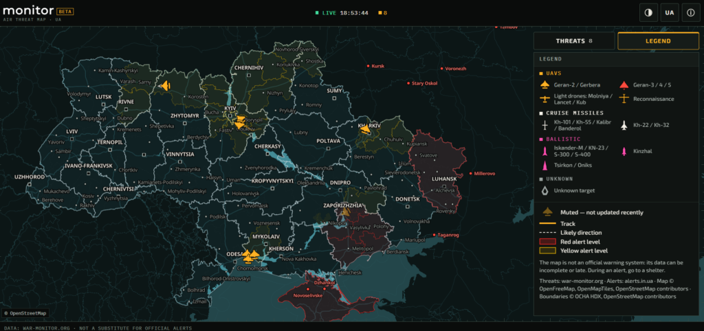
The drone data does not come from radar. The service draws on regional Telegram channels that post where drones and missiles are flying over their own oblasts. It cross-checks those posts to estimate what each target is, roughly where it is, and where it is heading, the project explains. The same page already lists cruise and ballistic missiles among the targets. It also says the map is free, ad-free, and needs no registration, and that it runs in a browser or on Telegram, designed to work on a phone with a weak signal.
A target log lists each drone’s district and course. Alert data comes from alerts.in.ua, and areas under alert turn red or yellow. The map refreshes about every 20 seconds while targets are airborne.
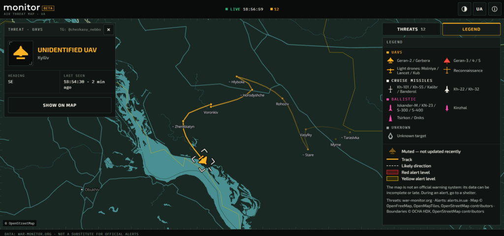
However, the developers warn that the dots are only estimates and show up late. Some targets slip through untracked. That is why “an empty map does not mean you are safe,” they wrote. When sirens sound, they urge people to rely on official signals and take shelter.
On 17 October, the Defense Ministry said that Ukraine’s Air Alert app now maps the approximate position and heading of some targets. These include cruise missiles, Banderol drone-launched missiles, and Shahed-type drones. The data comes straight from the Air Force over secure channels.

For security reasons, it carries no exact coordinates or real-time tracking and may lag. Ballistic missiles and anything faster than 2,000 km/h don’t appear at all. The ministry’s advice matches monitor’s: get to a shelter first, then check the map from there.
Read also
-
Starlink slowdown makes Ukraine’s Shahed-hunting drone maker rethink air-launched interceptors
-
Who capped Ukraine’s Starshield? “Ultimately POTUS,” Musk said. Ultimately Musk, reports now say
-
Nuclear safety risk grows: Russian-occupied nuclear plant’s cooling pond keeps sinking, Russia runs short of diesel and staff, Ukraine says


